|
Geographical Location of Kakatpur Pothi Ashram
Kakatpur, a small town in Odisha where Saint Achyuta's Taamrapothi is read by Shri Achyuta's directions
Shunyare rahile janibu taaku, yoga khelu thaee yoga ruparu
Aree yogi hele heba janaa je,
Aree guna na janile sehi samayare baata heijibu banare ...
Staying in Shunya you can know him, He plays yoga from a yoga-form
After being a Yogi he will be known to you
If you don't know the Guna (character/properties), in that time you will be wrongly led ...
(lines extracted from this song)
Kakatpur, a small town/moderate village, is situated in the Puri district of Odisha (Orissa), which is a state in the eastern part of India. The nearest major town is Pipili, which is approximately 20km from Bhubaneswar, the capital of Odisha (Orissa).
Kaktpur is reachable from both Bhubaneswar and the town of Puri.
For travelling from Bhubaneswar (BBSR) to Pipili, one can take a bus, and from there to Kakatpur, there are some inconvenient public transport system. If affordable, its suggested to take a Taxi (Cab).
For travelling from Puri to Kakatpur, one may drive on the beautiful marine drive, via Chandrabhaga and bypass of Konark.
The small Ashram or hut, where the Pothi (Oracle) is operated is situated at the front-end of the village, just facing the town-school. The Geographical Coordinates in Degree, Minute, and Second of Kakatpur are:
The following diagrams show the location of country, state, district, and exact location of this relatively less known village. The following image shows location of the state of Odisha (Orissa), within India:
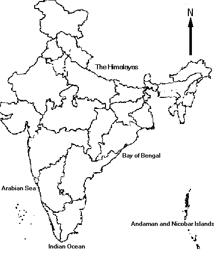
Location of the state of Orissa, within India.
The following image shows the location of the district of Puri, within Odisha (Orissa):
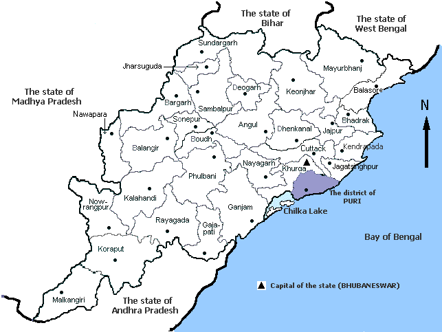
Location of the district of Puri, within Orissa.
The following image shows the location of Kakatpur within the district of Puri.
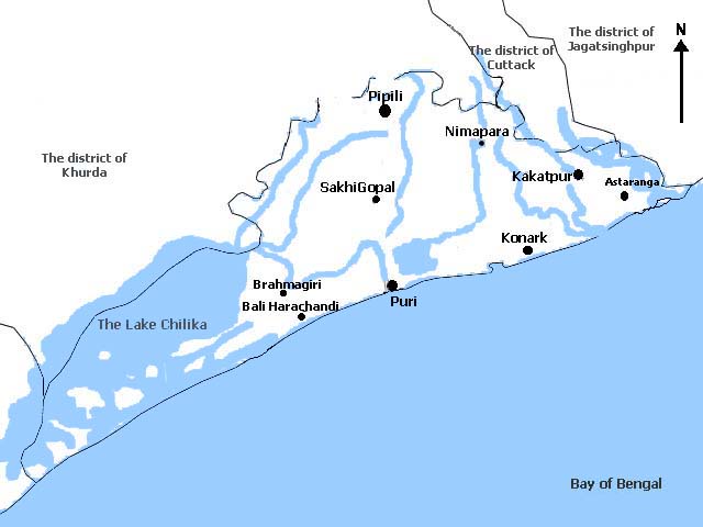
Location of Kakatpur within the district of Puri.
|